National Main Street Organization Launches Pilot Program to Bring New Resources to Downtown Revitalization in Three Colorado Towns

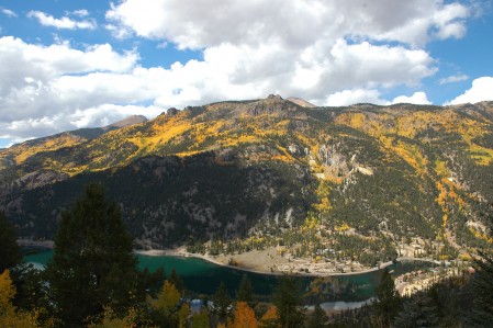
The National Main Street Center, Inc., has announced that three Colorado towns have been selected as demonstration sites to implement its revamped approach to comprehensive community revitalization and preservation-based economic development:  Brush, Lake City, and Steamboat Springs.  As a sponsoring partner, the Department of Local Affairs’ Colorado Main Street program will use the pilot to help integrate the new approach into existing and future Main Street communities across the state.

“Colorado will serve as an ideal place to test out our enhanced strategy and outcome-focused revitalization approach.  Each of these towns has so much to offer, and we look forward to partnering with the Colorado Main Street on the initiative,” said Patrice Frey, president and CEO of the National Main Street Center.  “Our updated methodology incorporates lessons we’ve learned in our decades of working with communities of all sizes and we are confident these pilot projects will demonstrate that our approach continues to be highly effective in breathing new life in our country’s historic downtowns and commercial districts.”

The three selected towns are top performers in Colorado’s Main Street program, recognized for success in energizing their local economies, empowering community residents, and celebrating their distinctive character and local historyy.  As participants in the demonstration project, they will benefit from recent strategic improvements to the Main Street Center’s revitalization methodology that for 35 years has helped transform historic downtowns and urban neighborhoods nationwide.

Local leaders will receive 12 to 18 months of organizational capacity building and hands-on technical assistance from national experts on how to best involve the community in revitalization effors, plan and executive long-term strategic action, and effectively measure the impact of those efforts.

Originally launched as a program of the National Trust for Historic Preservation in 1980, the National Main Street Center pioneered an incremental, volunteer-driven strategy to help flagging downtowns countereract booming suburban growth.  This novel approach was in stark contrast to the urban renewal projects that were destroying commercial districts and neighborhoods all over the country.  By tapping two important community resources, citizen participation and its older and historic buildings, the Main Street Approach has helped reinvigorate America’s historic downtowns and commercial districts in cities and towns across the country

Posted November 17, 2015 on the National Trust for Historic Preservation website.

Spruce Beetle in Hinsdale County

Below is a link to a Quick Guide produced by the Colorado State Forest Service to promote knowledge transfer with regard to the Spruce Beetle in the Colorado’s spruce forest ecosystem..

Spruce Beetle Quick Guide

Gunnison Country Association of REALTORS Monthly Indicators for October 2015

(Gunnison, Crested Butte and Lake City areas 2014 to 2015)

New Listings were up 10.5 percent (Lake City:  down 52.9 percent) for single family homes and 6.3 percent (Lake City:  down 50 percent) for townhouse-condo properties.  Pending Sales decreased 78.6 percent for single family homes and 95.2 percent for townhouse-condo properties.

The Median Sales Price was down 0.5 percent to $338,400 (Lake City:  $220,000) for single family homes and 22.7 percent to $218,500 (Lake City:  no change) for townhouse-condo properties.  Days on Market decreased 24.8 percent for single family homes but increased 39.9 percent for condo properties.

Interest rates are an area to pay attention to as rate hikes are widely expected before the year ends.  The Federal Reserve Bank has skipped two opportunities to raise rates this fall, but the final meeting in December will likely include a minor rate hike.  Although we are headed into a slower time of year, as housing activity goes, there are still many nuggets of optimism to mine from monthly figures.

Lake City Colorado Fire Rating Drop 2015

In the Silver World Newspaper dated September 11, 2015, there is an article with regard to the “dramatic drop in the local fire rating classification from 6 to 4 effective July 1, 2015.”

Hall Realty would like to encourage all home and business owners in the Lake City and immediate area to contact your insurance company and inquire as to a possible reduction in your current policy premium.

We hope this Thanksgiving finds you and your families well.  As always, Hall Realty appreciates your continued business support.

Safety in the Colorado Mountains

Hinsdale County Search and Rescue is a unit of the Hinsdale County Sheriff’s Office.  It is an all-volunteer organization, trained and equipped for search and rescue on mountainous terrain or in extreme weather.  HCSAR provides extensive training for its members and researches mountain rescue equipment and techniques.  The organization’s diverse membership includes climbers, engineers, healthcare providers, and other professionals.  HCSAR is an all-volunteer, non-profit organization.

Colorado Mountain Hazards

Because of Colorado’s highly variable climate and terrain, backcountry users need to educate themselves before venturing out.  Weather can change rapidly.  Check the forecast and keep an eye on the sky to anticipate changing conditions.

Lightning:  Lightning can strike anywhere but tends to hit high places.  In Colorado, summer afternoon thunderstorms are common.

Dramatic Temperature Drops:  Snowfall happens – even in summer!

Precipitation:  If you get wet, it’s difficult to stay warm.

High Water:  Water levels in Colorado streams and rivers can rise quickly.  High water from flash floods or snowmelt is possible.

Heat/Sun:  Keep well hydrated; avoid sunburn, even on cloudy days.  The sun’s radiation is intesified at higher altitudes.

Terrain:  Hazards caused by cliffs, loose and rocky slopes, steep snowfield, avalanche-prone slopes or ice require special skills or avoidance altogether.

Wildlife and Plants:  Colorado is home to bears, mountain lions, snakes, bees, mosquitoes, ticks, and other wildlife.  Know how to identify and avoid plants such as poison ivy, cactus, and thistle.

High Altitude:  Substantial increases in altitude over a short time may pose a serious risk.  Affects of alcohol and caffeine are magnified at high altitude, and can lead to more rapid dehydration and impaired judgement.

Human Responses:  Consequences of these hazards might include:  hypothermia, frostbite, altitude sickness, dehydration, sunburn, rashes, snow-blindness, heat exhaustion, and heat stroke.  Proper training is essential to prevent, recognize, and treat these conditions.

Have a Safe Trip

Before you go:

  • Tell someone where you’re going and when you’ll be back.
  • Be prepared.  Bring appropriate equipment.
  • Gather information on the attractions and hazards you may encounter.
  • Check the weather report, but don’t depend on it.

While you are out:

  • Travel within your ability and knowledge.
  • Use good judgement when choosing a route or deciding when to turn back.
  • Be responsible for your own safety and the safety of others.
  • Be prepared for the unexpected.  Consider making contingency plans in case of emergency.

If you run into problems:

  • Stop – Think – Evaluate Options- Make a Plan.
  • Don’t be afraid to ask for help.  A rescue will be more effective if requested early.
  • If lost or stranded, stay in a safe place where you can hear rescuers calling and make yourself visible.  Attempt to contact rescuers.
  • Be aware that it could take some time for rescuers to reach you.

Children in the Outdoors

Take responsibility for children under your care.  Until they learn to recognize and avoid hazards, children are especially at risk:

  • Prepare them with the proper equipment.
  • Teach children about local animals and hazards.
  • Discuss what to do in case of separation or other emergency.
  • Take advantage of available resources to teach children outdoor safety.
  • Be sure they are eating and drinking enough.

Take time to teach your children outdoor safety.  It could be the most valuable education they get.

Hiker’s Card (CORSAR)

What is the CORSAR card?

CORSAR stands for Colorado Outdoors Recreation Search and Rescue.  Fees collected go to the CO Search and Rescue Fund for search and rescue missions, training, and equipment.  (A portion of hunting and fishing licenses and OHV/snowmobile registrations also go to the fund.)

Where can I get one?

Cards are available for $3 at the Visitor’s Center, Sheriff’s Office , and some local businesses.

Why should I get one?

To support SAR in Colorado.  Also, if you have to be rescued, you may be liable for mission expenses.  If you hold a CORSAR card, CO hunting or fishing license, or other participating registration, most, if not all of your rescue expense may be covered by the Fund.  (Medical helicopter evacuations are NOT covered by the CORSAR fund.)

Use Your Head! It’s one of your best tools.

Items to Consider

Consider taking a few “essential” items with you:

  • Water
  • Extra Food
  • Extra Clothing
  • Waterproof Clothing
  • Map, Compass, GPS
  • Sunglasses and Sunscreen
  • Flashlight (spare batteries & bulb)
  • First Aid Supplies
  • Matches, Lighter, Firestarter (in waterproof container)
  • Knife
  • Whistle
  • Cell Phone (battery fully charged)

Cell phones may help you summon emergency help quickly.  However, battery life is limited and coverage is unreliable in the mountains.  Consider turning your cell phone off unless needed.

Serving Hinsdale County and beyond…for further information, to make donations, or to volunteer, please contact:

Hinsdale County Search and Rescue
P.O. Box 324
Lake City, CO  81235
970-944-2291
 
(This information was taken from the Hinsdale County Search and Rescue, Lake City, Colorado pamphlet, 2/25/2010 version)


Fourteeners Lake City Community School Information for Prospective Families

The award-winning Lake City Community School is rated as one of the top public schools in the State of Colorado, by the Colorado Department of Education.  There are 178 school districts in the state.

The Lake City Community School has consistently scored very highly in the areas of academic achiemvement on state exams, academic growth on state exams, and post-secondary and workforce readiness, as determined by performance on the Colorado ACT, dropout rate, and graduation rate.

The Lake City Community School has been recognized as a John Irwin School of Excellence (https://www.cde.state.co.us/cdeawards/johnirwin) several times, and is a District Accredited With Distinction  (https://www.cde.state.co.us/cdeawards/districtsaccreditedwithdistinction) by the Colorado Department of Education.

In addition, the school has a low student to teacher ratio, a modern building with new additions, and broad community support for the students, teachers, and administration.  There are approximately 100 students in pre-school through grade 12 enrolled in school.

Please visit www.lakecityschool.org for more information about the school’s mission, values, educator effectiveness, special education and more.  We invite you to contact us with your questions, and discuss enrolling your child or children in the Lake City Community School.

Dr. Leslie Nichols, Superintendent
Lake City Community School
Hinsdale County School District RE-1
614 N Silver Street
P.O. Box 39
Lake City, CO  81235
970-944-2314 

(This information was taken from www.lakecityschool.org)


Patented Mining Claim Information

Mining Claims

PATENTED MINING CLAIM:

A patented mining claim is one for which the Federal Government has passed its title to the claimant, making it private land.  A person may mine and remove minerals from a mining claim without a mineral patent.  However, a mineral patent gives the owner exclusive title to the locatable minerals.  It also gives the owner title to the surface and other resources.  This means:  You own the Land as well as the minerals. (Hall Realty Mining Claim Listings are all Patented Mining Claims.)

UNPATENTED MINING CLAIM:

An Unpatented mining claim is a particular parcel of Federal land, valuable for a specific mineral deposit or deposits.  It is a parcel for which an individual has asserted a right of possession.  The right is restricted to the extraction and development of a mineral deposit.  The rights granted by a mining claim are valid against a challenge by the United States and other claimants only after the discovery of a valuable mineral deposit.  This means:  You are leasing, from the governmnet, the right to extract minerals.  No land ownership is conveyed.

TWO TYPES OF MINING CLAIMS:

  1. LODE CLAIMS: Deposits subject to lode claims include classic veins or lodes having well defined boundaries.  They also include other rock in-place bearing valuable minerals and may be broad zones of mineralized rock.  Examples include quartz or other veins bearing gold or other metallic minerals and large volume but low-grade disseminated metallic deposits.  Lode claims are usually described as parallelograms with the longer side lines parallel to the vein or lode.  Descriptions are by metes and bounds surveys (giving length and direction of each boundary line).  Federal statute limits their size to a maximum of 1,500 feet in length along the vein or lode.  Their width is a maximum of 600 feet, 300 feet on either side of the centerline of the vein or lode.  The end lines of the lode claim must be parallel to qualify for underground extralateral rights.  Extralateral rights involve the rights to minerals that extend at depth beyond the vertical boundaries of the claim.
  2. PLACER CLAIMS: Mineral deposits subject to placer claims include all those deposits not subject to lode claims.  Originally, these included only deposits of unconsolidated materials, such as sand and gravel, containing free gold or other minerals.  By Congressional acts and judicial interpretations, many nonmetallic bedded or layered deposits, such as gypsum and high calcium limestone, are also considered placer deposits.  Placer claims, where practicable, are located by legal subdivision of land (for example:  the E 1/2 NE 1/3 NE 1/4, Section 2, Township 10 South, Range 21 East, Mount Diablo Meridian).  The maximum size of a placer claim is 20 acres per locator.

TWO TYPES OF MINERAL ENTRIES:

  1. MILL SITES: A mill site must be located on nonmineral land.  Its purpose is to either (a) support a lode or placer mining claim operation or (b) support itself independent of any particular claim.  A mill site must include the erection of a mill or reduction works and/or may include other uses reasonable incident to the support of a mining operation.  Descriptions of mill sites are by metes and bounds surveys or legal subdivision.  The maximum size of a mill site is 5 acres.
  2. TUNNEL SITES: A tunnel site is where a tunnel is run to develop a vein or lode.  It may also be used for the discovery of unknown veins or lodes.  To stake a tunnel site, two stakes are placed up to 3,000 feet apart on the line of the proposed tunnel.  Recordation is the same as a lode claim.  Some States require additional centerline stakes (for example, in Nevada, centerline stakes must be placed at 300-foot intervals).  An individual may locate lode claims to cover any or all blind (not known to exist) veins or lodes intersected by the tunnel.  The maximum distance these lode claims may exist is 1,500 feet on either side of the centerline of the tunnel.  This, in essence, gives the mining claimant the right to prospect an area 3,000 feet wide and 3,000 feet long.  Any mining claim located for a blind lode discovered while driving a tunnel relates back in time to the date of the location of the tunnel site.

The above Mining Claim information is from http://www.1881.com Investments.

Colorado’s Economy Ranked 2nd Best in U.S.

Good news for Colorado, Good Economy has yet to filter over to the Western Slope

Colorado’s Economy is ranked second best among the nation’s 50 state economies and Washington, D.C., according to Business Insider.  Colorado’s housing market had the most improvement in the country, with house prices rising 11.2 percent between Q1 2014 and Q1 2015.  The state’s 2014 gross domestic product (GDP) growth rate of 4.7 percent also was very strong, and was the fifth best among the states.  Business Insider ranked the economies of the states and D.C. on seven measures:  unemployment rates, gross domestic product per capita, average weekly wages, and recent growth rates for nonfarm payroll jobs, GDP, house prices, and wages.  While not factored into the ranking, the study looked at Fortune 1000 companies headquartered in each sate, as well as the industries that had a disproportionately large share of employment in each state according to their location quotients.  This provided a little more insight into what makes each state economy tick.  Dish Network, Western Union, and Chipotle are three of the 23 Fortune 1000 companies headquartered in Colorado.

Gunnison Country Association of REALTORS Monthly Indicators for August

August 2015 (Gunnison, Crested Butte & Lake City areas)

New Listings were up 34.5 percent for single family homes but decreased 14.3 percent for townhouse-0condo properties.  Pending Sales decreased 93.3 percent for single family homes and 78.1 percent for townhouse-condo properties.

The Median Sales Price was up 15.0 percent to $425,000 for single family homes but decreased 13.5 percent to $179,500 for townhouse-condo properties.  Days on Market increased 12.1 percent for single family homes but decreased 3.5 percent for condo properties.

Statistics released by the U.S. census Bureau and the Department of Housing and Urban Development indicate that privately-owned housing starts in July 2015 rose 10.1 percent compared to last year to the highest level the market has seen since October 2007.  This bodes well for the eventual landing of a flock of potential buyers currently holding in a rental pattern. As ideal summer weather diverges toward autumn, we will begin to see some seasonal relaxation, but the market should still look positive when compared to last year.

Sherman Townsite

Welcome to Sherman, one of the many small communitites in this region which boomed briefly, then slowly perished.  Named for an early pioneer, Sherman was founded in 1877, four years after the U.S. government and the native Ute Indians signed a treaty which opened up the San Juan Mountains to mining and settlement.

Sherman grew slowly at first, then expanded quickly in the 1880’s.  Mines in this area, such as the New Hope, Smile of Fortune, and Minnie Lee, yielded large amounts of gold, silver, copper, and lead.

The largest mine in this area, however, was the Black Wonder.  The Black Wonder was primarily a silver mine and was located on the hillside north of town.  For many years, this mine was the mainstay of Sherman’s economy.  Sherman, like many other mining towns in the San Juans, was basically a “one-mine town.”  Like a roller coaster, Sherman’s population and prosperity fluctuated with the fortunes of the Black Wonder mine.

Though Sherman was a relatively quiet community, residents here boasted optimistically of their town’s permanence and vitality.  In 1881, the Sherman House opened, offering “Good Accomodations for Travellers, Liquors, Wines, St. Louis Beer, and Cigars.”  A general merchandise store opened the same year, which “tempted the one hundred citizens to spend their money at home.”

During its peak in the mid-1880’s, the summer population of Sherman reached about 300 people, mostly miners.  During the fall, most residents left and few stayed in Sherman over the winter.  However, in the spring, after the snow had melted and the streams subsided, miners and merchants would move back into Sherman, repair their homes and stores, and resume their work.

Like many San Juan mining towns, Sherman’s downfall began in the 1890’s.  When the U.S. government went off the silver standard in 1893, the demand for silver dropped, creating a nationwide depression.  The drop in demand for silver forced the closure of scores of mines in the San Juans, and several in the Sherman area.

A second factor which led to Sherman’s decline was its poor location.  Situated at the confluence of Cottonwood Creek and the Lake Fork of the Gunnison River, and just downstream from Cataract Creek, the town was frequently flooded during the spring by snowmelt runoff.  Around 1900, a dam 147 feet high was built upstream to hold back the  churning waters, but a few days after completion, runoff from a cloudburst ripped the dam apart, and carried off much of Sherman as well.  Sherman never recovered from these setbacks, and by 1925, the town was deserted.

Little is left of Sherman today.  Still visible are the ruins of a few scattered cabins, many of which sit amidst stones rounded by streams and deposited by floodwaters.  The largest structure, the foundation of the Black Wonder mill, sits before you — a quiet reminder of this once thriving mining town.

Help preserve Sherman and other historic areas in this region so that future generations may enjoy them.  Please take only pictures and leave only footprints.  Thank you.

Bureau of Land Management

Realtor, Equal Housing, MLS